FAQ/ What is a Standard Geographic Mesh?
What is a standard geographic mesh?
response
A mesh used in Japan defined relative to latitude and longitude.
It is standardized as "JIS X0410 Regional Mesh Code".
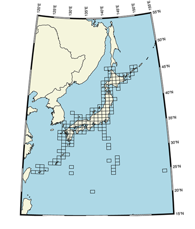
The range is shown in the figure.
 Figure: Extent of the Japan's standard area mesh
DioVISTA's latitude-longitude coordinates use a cubic mesh of the standard area mesh, or a mesh that subdivides it. The third-order mesh is a mesh with sides that are 45 seconds (1/80 degree) in the longitude direction and 30 seconds (1/120 degree) in the latitudinal direction. When converted into distance, it corresponds to about 1 km in both east and west and north to south.
However, the higher the latitude, the shorter the distance in the longitude direction. For example, in Sapporo City, Hokkaido, a side of 45 seconds in the longitude direction corresponds to 1,018 m, while in Naha City, Okinawa Prefecture, it is equivalent to 1,249 m.
The magnitude in the latitudinal direction is almost the same. For example, in Sapporo City, Hokkaido, a side of 30 seconds in the latitude direction is equivalent to 926 m, while in Naha City, Okinawa Prefecture, it is equivalent to 923 m.