FAQ/ Connecting an Overflow Levee to the Flood Model
I want to drain the overflowing water from the overflow embankment to the flood model.
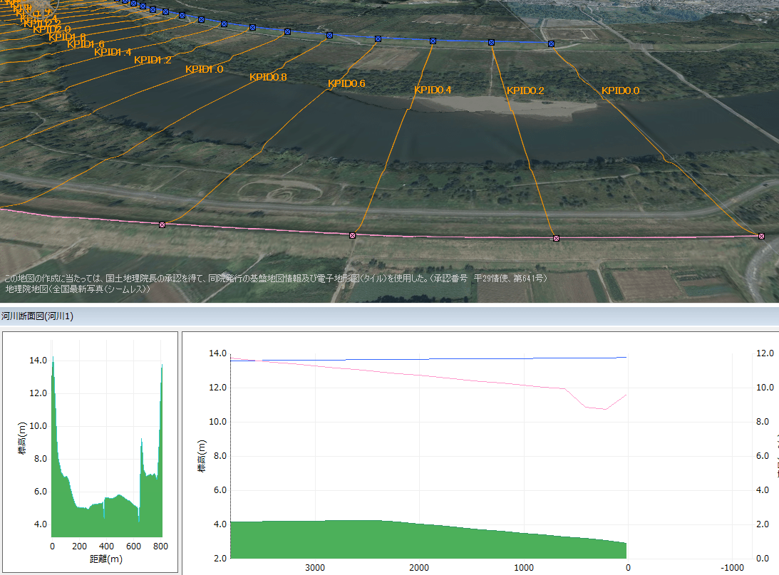
Should I edit the river cross-section and lower the levee top height on the right bank? River crossing data is given at 200 m intervals.
response
Modeling strategy
There are two ways to model overflow levees. Method 2 is used to drain the overflowing water from the overflow embankment into the flood model.
- [rivers] [Creating a new overflow levee] Create from >.
- The overflow coefficient and length can be set numerically.
- You can connect to a drainage area model.
- For details, please refer to Condition Setting Individual Operation / River / Overflow Embankment.
- Edit the river cross-section.
- It can be connected to a two-dimensional flood model.
- The details are described here.
Concept of transience by cross-sectional map editing
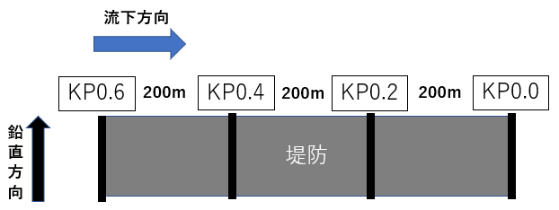
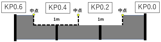
The following example shows how to configure a 400 m long overflow embankment between the river crossing KP0.2 and the crossing KP0.4.
The figure below shows the river embankment before the overflow is made.
The figure below shows the top height of the embankment on the right bank of cross KP0.2 lowered by 1 meter. Cross-section KP0.2 represents the interval from the midpoint of KP0.0 and KP0.2 to the midpoint of KP0.2 and KP0.4. This section is 200 m long. This operation lowers the levee height on the right bank by 1 m from the midpoint of KP0.0 and KP0.2 to the midpoint of KP0.2 and KP0.4.
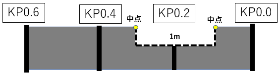
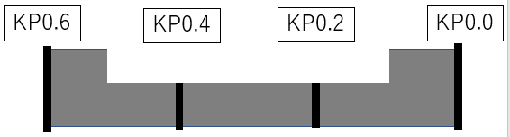
The figure below shows the height of the embankment on the right bank of crossing KP0.4 lowered by 1 meter. The cross KP0.4 represents the interval from the midpoint of KP0.2 and KP0.4 to the midpoint of KP0.4 and KP0.6. This section is 200 m long. This operation lowers the height of the embankment on the right bank by 1 m from the midpoint of KP0.2 and KP0.4 to the midpoint of KP0.4 and KP0.6.
These operations modeled a 400 m long overflow levee between KP0.2 and KP0.4.
DioVISTA Operating Instructions
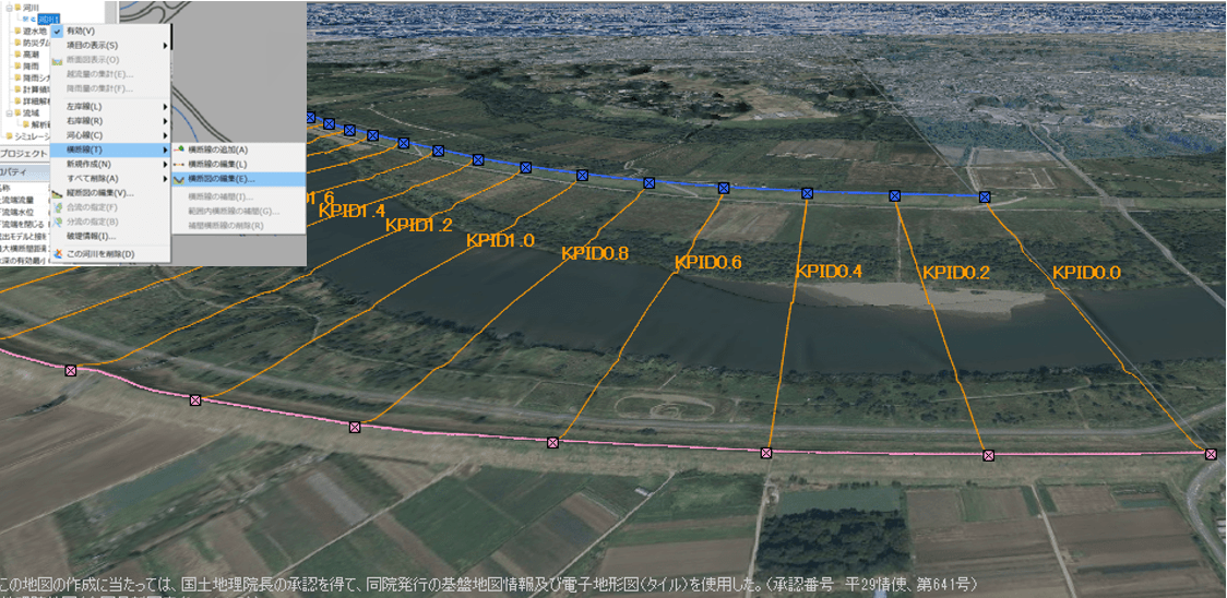
Here are the steps in the actual DioVISTA edit screen.
-
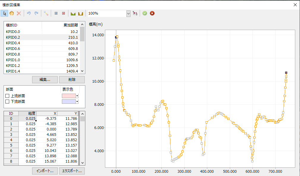
[rivers] Lower the height of the [Edit a cross-section] right bank top height of KP0.2 by 1 m from >. Lower the height of the point with the red marker on the left side of the screen by 1 meter.
-
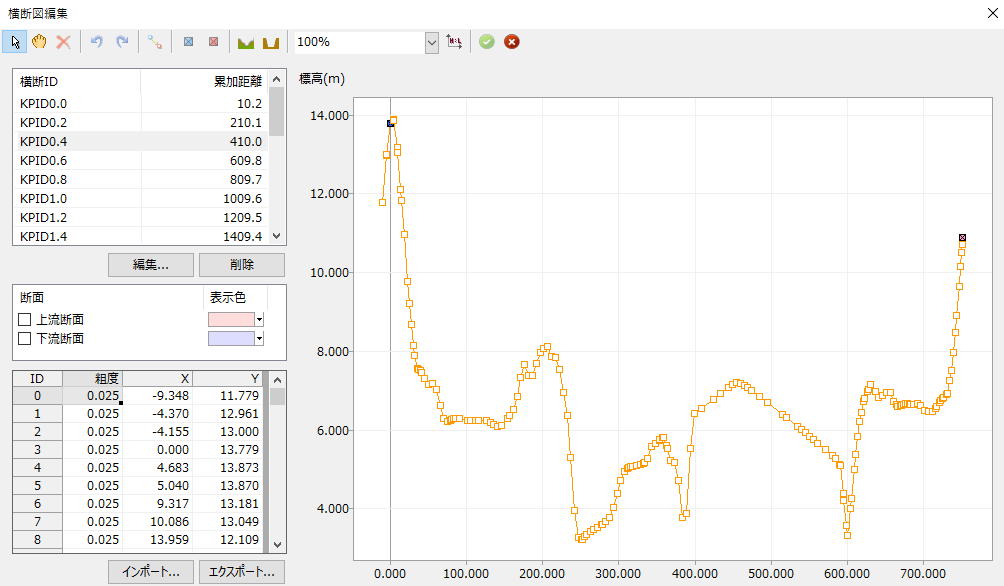
The same operation is performed for cross KP0.4.
- Save your changes.
- [rivers] > [Cross-sectional view display] .
- In the longitudinal map, focus on the height of the embankment top on the right bank (red line in the figure).
- The right bank position is lowered by 1 m between KP0.2 and KP0.4. You can see that the overflow levee was modeled.