Revision history
2022-12-09 (Version 3.4.7)
- (Enhancement) The upper limit of the size of the calculation area can exceed 10,000 x 10,000 cells.
- (Function enhancement) The effective minimum value of the water depth of the flood equation can be specified.
- (Function enhancement) Calculation time step width can be specified.
- (Function enhancement) Added the Water depth function to the simulation conditions .
- (Function enhancement) 3-decimal place display of water level and water depth.
- (Function enhancement) The upper limit of the number of meshes for the maximum envelope was set to 100,000.
- Build = 04ab447d43428f2df3d9d23a6112592a6f245e45
2022-02-04 (Version 3.4.6)
- Academic version released (license management by cloud)
- Build=05d6c3078aca2dc0bf4bc252747f569d5eb8cda2
2022-01-14 (Version 3.4.5)
- (Modified) The threshold for automatic adjustment of the time step was adjusted so that the calculation was stable.
- Build=26a34973d06df4c0f92664a9dead2603e86890f3
2021-12-28 (Version 3.4.4)
- (Function enhancement) The flow velocity can be displayed with arrows.
- (Function enhancement) Unequal flow analysis can be performed with river models.
- (Function enhancement) Refer to the online help site instead of PDF as help.
- The (function enhancement) online help site has been renewed.
- (Function expansion) It is now possible to output river water level and dam water storage in CSV format even by batch processing.
- (Data update) Land use data has been updated to the 28th edition.
- The time step was set to a multiple of 2. The initial value of the river time step was increased from 10 seconds to 16 seconds.
- (Correction) Reduced the number of cases of negative water depth that can occur when the main river is steep and smaller than the tributary and flows back from the main river to the tributary.
- Build=c5630a04da515ea46e337126d1f08cc9ae5a06d7
2021-02-12 (Version 3.3.0)
- (Function enhancement) The user interface language can be switched between Japanese and English.
- (Function enhancement) In the longitudinal map display of the river channel, it is now possible to switch whether the upstream is on the left or the right.
- (Function enhancement) The vertical axis of the river flow rate graph can be fixed.
- (Function extension) When outputting in the Ministry of Land, Infrastructure, Transport and Tourism CSV format, it is possible to output water depth etc. with three digits instead of two decimal places.
- (Function enhancement) When outputting in MLIT CSV and NetCDF formats, the water depth considered to be zero can be changed from 5 mm to 0 mm.
- (Function enhancement) Land use is now editable
- (Specification change) Specification change of retained basin
- H-V formula, function to specify minimum water level, maximum water level, and initial water level
- Export function of calculation results of detention basins
- (Specification change) Specification change of overflow embankment
- Ability to specify the operating mode (weir / gutter gate), top elevation, opening height, overflow coefficient
- Function to specify position and width numerically
- (Specification change) Installed with the installer.
- (Fix) Fixed a bug that the embankment does not work under certain circumstances.
- (Fix) Fixed a bug that prevented drainage from being completed in the drainage area of the drainage station under certain circumstances.
- Fixed: Support for screens less than 1024 pixels wide (playbars are displayed correctly).
- Fixed a bug in the pop-up position when using two or more displays.
- (Update) The development platform is now compatible with Visual Studio 2019.
- (Update)Updated NetCDF library (netcdf 4.3.0 to netcdf 4.7.3)
- Build=f4cfc6366d7b99d9bb0fe4c03934068e8226cadb
2020-01-29 (Version 3.2.2)
- Compliant with "Guidelines for Digitization of Flood Area Map Data (3rd Edition)"
- Break time when exporting in MLIT format WL_STATION. Support for updating to CSV
- Build=478e565c06892be005c272d9af0df40ba002a125
2019-11-08 (Version 3.2.1)
- Added a function to interpolate river cells that are no longer valid on the coastline from the maximum water level in the vicinity at maximum envelope output.
- Build=7ca79425821ca5f383e80083cd95c9648075abb7
2019-10-28 (Version 3.2)
- New river properties [Connection of rivers and floodplain cells] (for narrow rivers)
- Faster processing of 2D irregular flow models and river/floodplain connections (0-30% speedup)
- Reduced calculation error for the number of cells derived from[Center latitude] project properties
- When importing *.asc files, allow for errors so that they can be imported appropriately even with ArcGIS output accuracy.
- Build= ee7dd28174c6c512462ea212941fe1aeaf8790e6
2019-03-25 (Version 3.1.2.1)
- dfsConv64.exe option --fill-boundary added
- Build= 731bb07e76741363ba75e80f73cd4a452abc5ebb
2019-03-04 (Version 3.1.2)
- dfsConv64 .exe added options -N, -P
- Add [Application of HQ formula to drainage destination river]Property
- [Applying the HQ formula to confluences] Name changed to Property (before change [Apply HQ formula to confluence] )
- Build= af3ceed905dda5341ee0bcd24132a163635cd056
2018-10-03 (Version 3.1.1)
- Acceleration
- Faster calculation of river channel and floodplain (in the case of long rivers, it is up to twice as fast).
- River model enhancements
- Added the setting of the upper flow rate to apply the HQ formula.
- Added support for tabular HQ expressions.
- The effective minimum value of water depth and flow volume can be specified by the user.
- Added overflow levee option [Do not allow overflow into floodplains] .
- Exfiltration model enhancements
- The minimum basin area of the target for generating a falling waterline can be specified by the user.
- The inflow rate of flow from the waterfall line to the river can be specified using the average rainfall in the basin as a threshold.
- Display and output function expansion
- The water depth and water level of the position panel are displayed up to two decimal places.
- Even when only the time exemplified in the "Flood Expected Area Map Data Digitization Guidelines (2nd Edition)" is output, an option to aggregate from all time information in the log has been added.
- Information on the moment when the "house collapse risk zone (flooding)" flag is raised is output to a log file.
- Terms such as "building collapse risk" and "house collapse zone" have been unified into "house collapse risk zone (flooding)".
- Build= b18b02e5328c3d2c90a12c67447d5f9b22053ef6
2017-12-28 (Version 3.1.0.1)
- Added operation rules to the drainage station at the end of the stream.
- Build= 58d967c25e319964d1899f0ada6c302127a03cfc
2017-12-04 (Version 3.1)
- Changed the format of the manual (changed from PDF to .html)
- Added DioVISTA Flood Free Edition
- Build= 2e07277828bd3bb594187c18e2a03541948ce67b
2017-07-21 (Version 3.0.1.4.18)
- Added tipping weirs as river objects.
- Accelerated project initialization (about 10 times faster for long rivers).
- Build=4a8f14e61894947297632ed30ec9520f294ae67f
2017-07-04 (Version 3.0.1.4.17)
- Support for simulation with "Mesh with divided standard regional mesh".
- Added description of project properties to manual [Center latitude] .
- Added a function to export calculation results (ESRI ASCII raster format).
- Added detailed explanation to the manual function for setting the division rate of river divergences.
- Typographical correction in the manual (Table 4-1 Continuous equations conforming to the Manual 4th Edition of the Flood Equation Options were matched with Equation (4-7)).
- Added option to float variables to dfsConv (-R).
- The pump is now displayed in the simulation shape display.
- Build=683bd0535920f93800bd76868a8b104d74ba6d7e
2017-04-28 (Version 3.0.1.4.16)
- River channel dt > measures in case of flood dt
- Build=406fa3fc7b204662b9459533fdfb6f3c0eb9d110
2017-04-05 (Version 3.0.1.4.15)
- When outputting with a finer mesh than the calculated mesh, the water level is interpolated.
- Build=a8fffa2b6b519bb12ca722c4e00963591d86fe94
2017-03-09 (Version 3.0.1.4.14)
- Add [Valid value of Himon Shiki height]Project Properties
- Add [Backward compatibility (embankment index)]Project Properties
- Add [HQ formula applies to positive flow rate only]Project Properties
- Build=09377e25a1efbb57bd7f74410d8d2660b61e4461
2017-02-27 (Version 3.0.1.4.13)
- Added setting of effective value mode of Himonshiki height.
- Build= 44b6e1a1fb0fa70d1818bcee551a9083433f0c70
2017-02-16 (Version 3.0.1.4.12)
- Amendment to the method of granting boundary conditions for a breakdown THETA
- Build= f86b4c437baa174432b5edffa9075c3144ead8e5
2017-01-27 (Version 3.0.1.4.11)
- Added "Connect to runoff model" option for rivers and gutters
- Build= 9c3ec07a05b914f561cbf1f40c6735c0ddbec22e
2017-01-11 (Version 3.0.1.4.10)
- In the function of importing boundary condition time series from NetCDF for storm surge, when calculating values after the time stored in NetCDF, the last value is used without extrapolation.
- Build= ce52b453d127ed23bfb6342d539676b101ab31f6
2017-01-05 (Version 3.0.1.4.9)
- Added an improvement to capture boundary condition time series from NetCDF for storm surges that generally respond to cases where the coastline of the variable to be imported does not match the shoreline of the destination DioVISTA.
- Build= 350387d05c51062cd7b428fb6bf984b00e8d23b1
2016-12-29 (Version 3.0.1.4.8)
- As the discharge mode of the disaster prevention dam, the inflow and outflow functions can be selected.
- As the discharge mode of the disaster prevention dam, the water level and runoff function can be selected.
- As the discharge mode of the disaster prevention dam, it is now possible to select the runoff time series.
- The maximum water level (proviso operation start water level) can be set for disaster prevention dams.
- A drainage station could be installed at the end of the main river.
- Added a weir mode to the drainage station.
- It is now possible to set the opening time series of the gutter gate at the drainage station .
- It is now possible to choose whether to go beyond the virtual wall and reverse overflow from the floodplain into the river.
- Virtual walls are now correctly disabled at upstream and downstream ends.
- Flood cells in rivers are correctly disabled at upstream and downstream ends.
- Added function of dfsConv: When there are multiple levees, it is now possible to specify the target levees.
- Added function of dfsConv: The first date time to be output can be specified.
- Modify the property string([No inflow from flooding], ). [Backflow Permission]
- Build= 4d179a2ce990fcddf3a2c1b54bfe472e269a8e7d
2016-11-29 (Version 3.0.1.4.7)
- Virtual walls can be set for each distance marker from each river channel cross-section.
- It is now possible to select the presence or absence of a reverse levee.
- Flood cells in rivers are now automatically disabled.
- The description of the breach of the levee in the manual was made independent as a chapter.
- Build= 6baad04d1e971e87f2508165cc708dc29fde4647
2016-11-01 (Version 3.0.1.4.6)
- Added import function to NetCDF compute area
- Added condition capture function from NECF of storm surge
- Added "Questions and Answers" to the manual
- Removed "What's New" tag from manual
- Build= 03796219f9e4487b19c46a2dfc0b59df9ab75b94
2016-10-24 (Version 3.0.1.4.5)
- Added specifications for drainage stations and faster drainage processes ("Flood Model", "Boundary Conditions")
- Build= d2ecfbec54b0dd16e1ae0422b7dfb47d8607ec17
2016-10-03 (Version 3.0.1.4.4)
- Added descriptions of porosity and transmittance to the manual ("Map data", "Flood model").
- Build= 6907c53710cd3541f726612fa556d29a9f4d2e44
2016-09-13 (Version 3.0.1.4.3)
- Negative values were allowed as lateral inflow of rivers.
- It was made possible to close the flow of the river.
- Added description of input/output function-KML to manual.
- Added description of map data - KML to manual.
- Build= 680fdca1d3a41ee957bcf1466bff5931ef91ef02
2016-08-09 (Version 3.0.1.4.2)
- Added conversion function to batch processing function
- Added river and floodplain connection option
- netCDF specification changed to draft Digitization Guidelines (3rd Edition)
- Build= 854445f2d8a591f5582c02279952ea7938fbe04
2016-05-31 (Version 3.0.1.4.1)
- Added batch processing function
- Added features and editions (Section 1.2) to the manual
- Build= 9730fc956b465f64e242db057b43f5c705e36778
2016-03-29 (Version 3.0.1.3)
- Added a function to correct the calculated river water level with the HQ formula.
- Added function to set the overflow coefficient alpha and theta.
- Added function to set the building resistance coefficient per length
- Added a function to output the maximum water level in the longitudinal direction of the river.
- Added function to import river profile data
- Added function to output overflow time series
- Even if there is an extra "," which is added when saving the CSV of cross-sectional data in Microsoft Excel, it will work.
- Build= ad170891c5cee0a896523136baa82ba3e2ecf041
2016-03-07 (Version 3.0.1.2)
- Added description of maximum immersion depth to the calculation result export function (text format)
- Added effective rainfall estimation function
- Added storm surge function
- Build= c2b1bebaae009f5027776fa02fd950d50d099f51
2016-02-23 (Version 3.0.1.1)
- Changing the format of the manual
- Added 8 chapters to the manual.
- Build= 99971f5471b3ba76f32814e10d39177726b16cf4
2016-01-05 (Version 3.0.1.0)
- Give build number
- Build=88ff5da5b6b5839a200a8b3098a336b4a55eb4dc
2015-12-25 (Version 3.0.1)
- Add drainage station
- The development platform is now compatible with Visual Studio 2015.
2015-02-27 (Version 3.b2)
- Added two-dimensional indefinite flow equation (with advection term)
- The development platform is now compatible with Visual Studio 2012.
2013-06-28 (Version 3.b1)
- Moved from 32-bit to 64-bit.
- The development infrastructure was ported from Visual Studio 2003 to Visual Studio 2010.
- Added downward flooding function
2011-03-01 (Version 2.6)
- Added runoff analysis function using distributed runoff model with saturation unsaturation mechanism
- Addition of Drainage Area Function
- Addition of river diversion function
- Multithreading support
2009-03-26 (Version 2.5.0.b)
- Runoff analysis function using distributed runoff model was added.
- It made it possible for rivers to merge with each other.
- Rainfall mesh data can be imported.
- It can be operated continuously for 24 hours.
2008-06-01 (Version 2.3)
- Addition of embankment function
- Added maximum immersion depth display
2008-02-01 (Version 2.1)
- Accelerate terrain analysis
2007-04-01 (Version 2.0)
- Added risk indicator
- Added one-dimensional river analysis function
- Added distributed runoff analysis
2007-01-01 (Version 1.8)
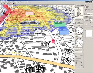
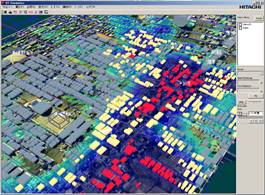
- Three-dimensional display of buildings
- List of flooded households
- Added tunnel function
- Added pump function
- Added sewage function
- Added spillway function
2006-09-01 (Version 1.1)
- Various options for storm surge and dam body destruction have been added.
2006-06-30 (Version 1.0)
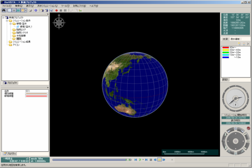
- Hitachi Engineering Service Co., Ltd. has released DioVISTA/FloodSimulator Version 1.0.
- We created a function to calculate flooding on a global 3D GIS.
- As boundary conditions, we created levees and overtopping, inland flooding due to rainfall, and water column collapse.
2005-01-27 (Prototype 2)
- Faster prototype calculation logic.
2004-07-14 (Prototype 1)
- A prototype that displays the calculation results on GIS while calculating flooding, and at the same time automatically extracts flooded houses under and above floors, was prototyped at Hitachi, Ltd. Central Research Laboratory.
Last update:
2023-03-20