Toolbar/ Flood simulation function
This is a function related to simulation, such as running and stopping simulations.
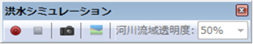 Figure: Flood simulation function
Table: Flood simulation menu
| icon | item | function |
|---|---|---|
 |
Start Simulation | Display the simulation start screen and perform calculations. |
 |
End of Simulation | Finish the simulation calculation. |
 |
snapshot | [Save As] Display the dialog and save the map image displayed in any location in bmp/jpg/png format. |
 |
Water level and topographic cross-sectional display | Displays a cross-section of the water level and terrain. If the calculation result is not displayed, it is inactive. |
 |
River basin transparency | Adjusts the transparency of the river basin detail display. |
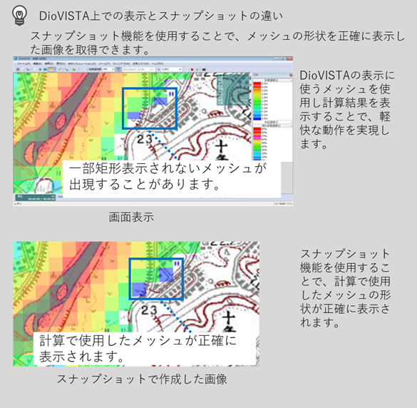 Figure: Difference between display and snapshot on DioVISTA
Reference: Technical Reference/ Flood Model/ Misalignment of the inundation depth displayed on the map
Last update:
2023-03-20