FAQ/ Terrain elevation of embankments
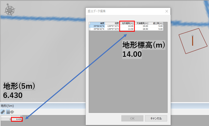
[embankment] is [Terrain elevation] different from the elevation of the imported terrain.
The figure shows the embankment data. [Terrain elevation] is 14.00 m. However, when the ground height at the same position [Calculation area] was examined from > > [topography] > [5m] , [topography] the ground height was 6.340 m. Why are they not the same?
response
[embankment] is [Topographic data] taken from DioVISTA's terrain data. [Calculation area] is not retrieved from.
[embankment] The [Terrain elevation] [project] [property] [Topographic data of interest] terrain data of the mesh size set in in is adopted.
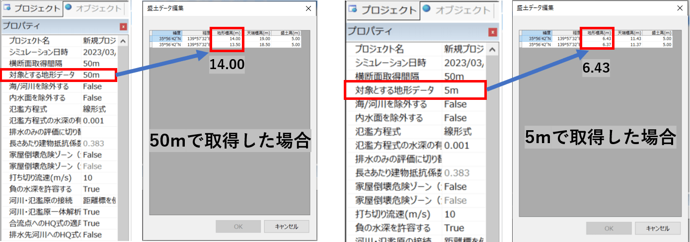
You can also convert terrain data that you want to use for embankments to DioVISTA terrain data. To do this, use a map converter (sold separately).
Note that if you import [Calculation area] [topography][Embankment data][Terrain elevation] into after [Embankment height]setting the embankment[Top elevation], will not be rewritten. Therefore, [Top elevation] the value specified as[topography] can remain available after you import .