Project/ Watershed/ Analysis Coverage
Main applications
- When calculating the runoff model, you can optionally set the watershed analysis extent.
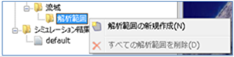 Figure: Watershed analysis extent
Table: Watershed Analysis Area Context Menu Items and Functions
| Context menu items | function |
|---|---|
| Create a new analysis area | Create a new analysis extent area. |
| Delete All Analysis Areas | Delete all analysis extent areas. |
An example of not specifying an analysis extent is shown below and explained by comparison.
Create a new analysis area
-
Specify the area on the map where you want to create the analysis area with a mouse click.
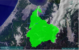
Figure: Area designation to create an analysis area -
To revert to the previous state, right-click or[BackSpace] press the key.
-
To cancel the creation,[Esc] press the key.
-
Confirm with double click or enter.
-
Set conditions related to the analysis range on the Properties screen.
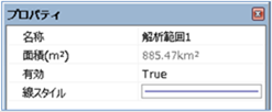
Figure: Properties screen of analysis area settingsTable: Analysis Area Property Names and Settings
Property Name What to set name Enter a name of your choice. Area (m^2) Displays the area of the specified analysis area on the map. valid Enable/disable settings.
The initial value is True.
True: Enabled:
False: DisabledLine Style Specify the line style (line type/line width/line color) to be displayed on the map.
The initial values are as follows:
Line Type: Solid
Line Width: 2px Line
Color: 128,128,192 -
If you run the simulation with the analysis area specified, the watershed analysis is aborted.
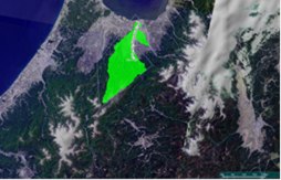
Figure: Running a simulation with a specified analysis area
Delete All Analysis Areas
When you select the menu, a confirmation message appears. [Yes] Click the button to delete all analysis areas.
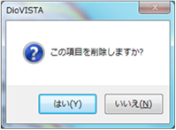 Figure: Delete all analysis areas